Lutruwana
Lutruwana is a large island set far apart from the other lands of the Great Ring—so distant from the main shipping lanes that some cartographers do not even consider it a part of the Ring at all. Its nearest neighbor is Usran, in the Southern Region, nearly 600 miles to the east. While there is some limited trade with the islands to the east and north, most merchants have never made the journey, and Lutruwana is not regarded as a friendly port to outsiders. A massive reef system stretches along the island's northeastern coast, posing a hazard to shipping and further discouraging merchants from approaching Lutruwana.
The island is sparsely inhabited by several related Kikipua ethnicities who were never subjects of the Great Ring's historical empires (such as Muria or the Telmunic Empire), and it seems unlikely they ever will be. Collectively, they are sometimes called the Lutarra, though this name is not universally embraced. Many internal groups regard it as a label applied only to outsiders native to Lutruwana, and not to themselves. Most of the island remains untamed wilderness, encompassing a remarkable range of biomes: grasslands, eucalyptus forests, rainforests, mountains, and moorlands. What Lutruwana is most renowned for - among those who know anything of it - is the abundance of species found nowhere else.
Notable Spirits
The people of Lutruwana honor many gods, but only one is known beyond its shores: Motjimanopan, the Life-Weaver. According to legend, Motjimanopan is the source of the island’s extraordinary biodiversity. He is said to spend day and night weaving new plants and animals, then setting them loose upon Lutruwana to flourish or fade as fate allows. When the Lutarra encounter one of these odd creations - such as the trunked-nose bat, or the tiger-owl, they acknowledge the creativity of Motjimanopan and go about their business - assuming that this particular creation has no interest in eating them, of course.
Geography
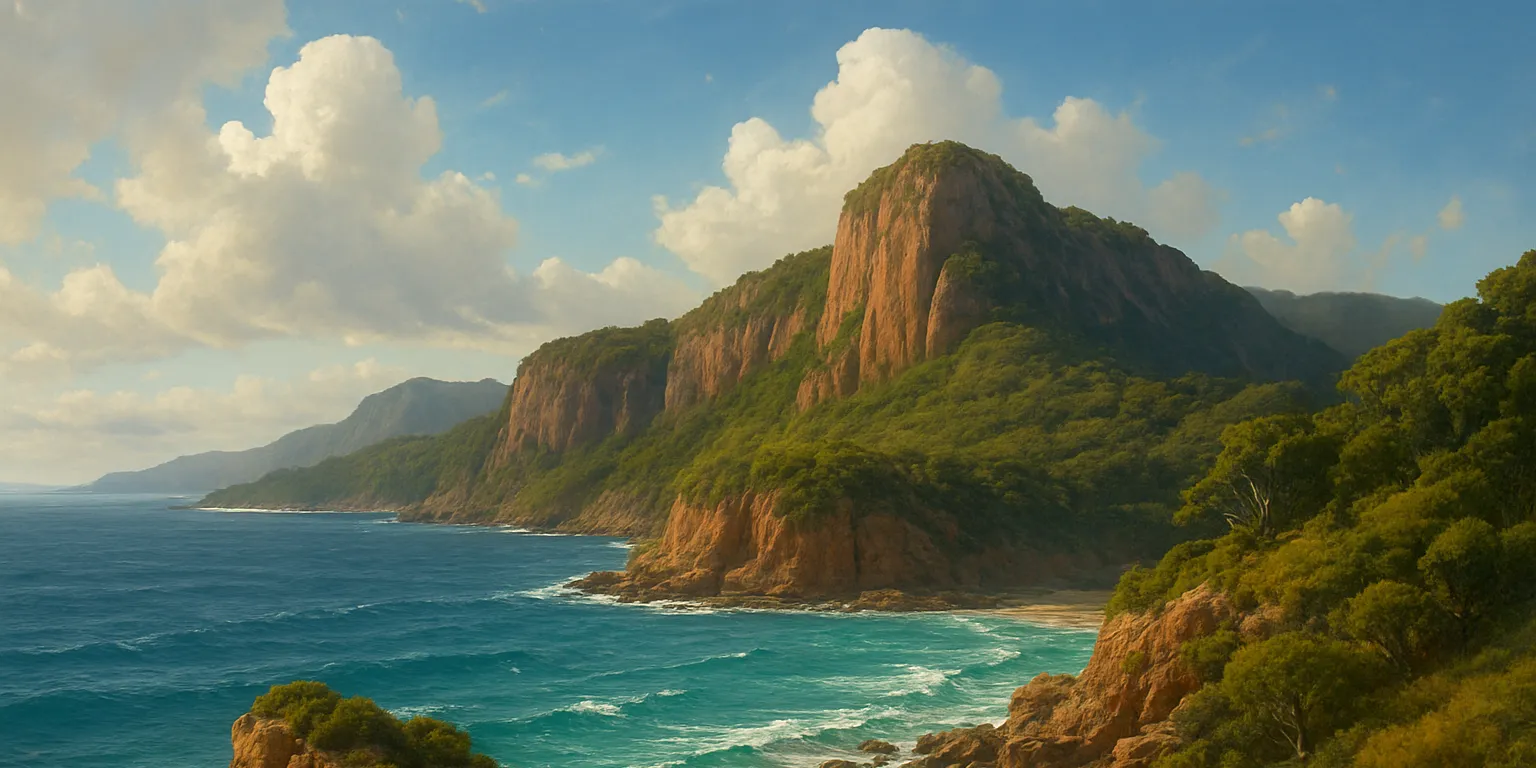
Lutruwana is shaped roughly like an arrowhead, pointing south. At its center rise the Payanna Tura mountains, home to the island's highest peak, Waranta Tura. To the east of the range stretch vast grasslands, where most of the Lutarra live, while the western side of the island is far more densely forested. Dozens of rivers spring from the Payanna Tura, carving deep canyons through the central highlands - many of whose valleys shelter unique ecosystems found nowhere else.
Geographic Details
Location: Southwestern RegionLatitude: 5.49 degrees South
Longitude: 28.25 degrees West
Average Elevation: 20 ft
Highest Point: 5,305 ft
Lowest Point: -3 ft
Area: 26,410 sq mi
Related Articles
This article was originally written for Spooktober 2024. You can find all of my Spooktober Articles at Spooktober Central.
This article was originally written for Spooktober 2023. You can find all of my Spooktober Articles at Spooktober Central.


This is officially the coolest island in the Million Islands <33
I’m glad you like it!