Duhan (ˈdu.han)
"Let the Gubatok be in their bamboo forests - there's nothing much of value there, anyway."
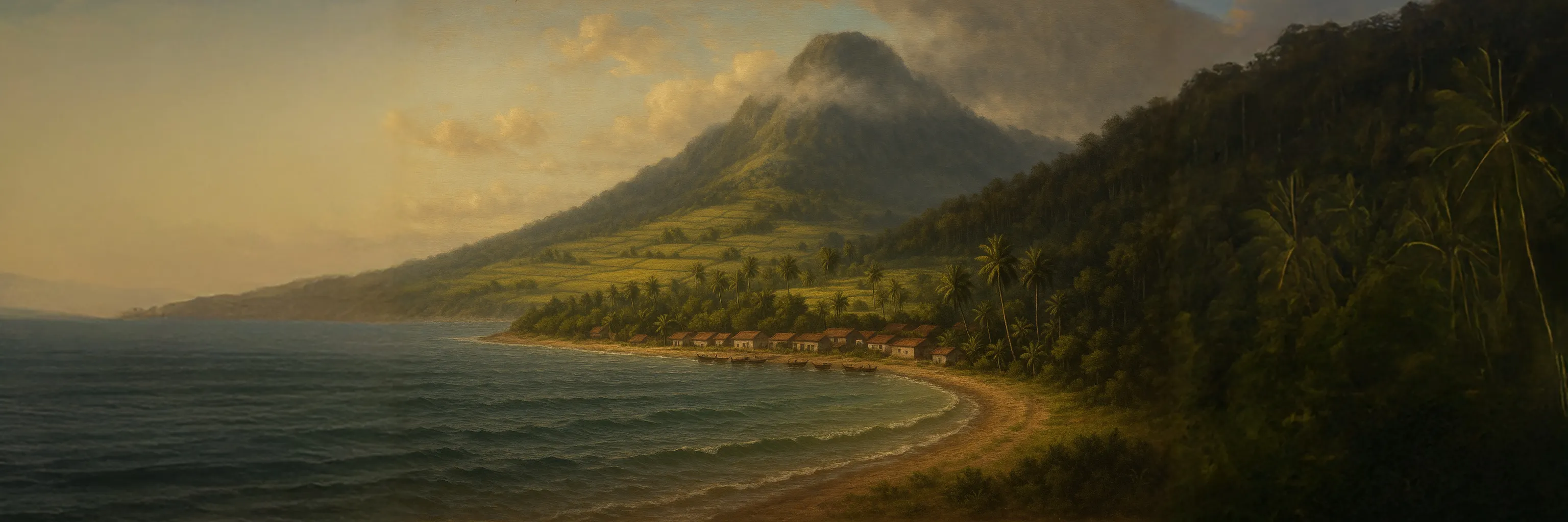
Duhan is an island in the Kapuluan archipelago and the seat of the Lalawigan ng Duhan. It is the ancestral home of the Tawung people, although they have been largely displaced to the island’s western region by the Tagápulo settlers from Pulo. This western region is known as Gubatung Kawayanan, meaning “The Bamboo Wilds,” and is often regarded as backward and uncivilized. The Tagápulo refer to the Tawung by the name Gubatok, which roughly translates to “Forestling.” The eastern part of the island, called Silangang Duhangin (“East Duhan”), is predominantly populated by Tagápulo immigrants. The provincial capital of the Lalawigan ng Duhan is located on the eastern coast, in the town of Tagpuan.
Duhan is one of the oldest territories of the Tagápulo Empire, having been conquered even before the entirety of Pulo. Tagápulo fishing villages along the eastern coast gave the Empire an initial foothold on the island, from which they gradually pushed the Tawung further and further west. In response, the Tawung tribes unified for the first time and sent an emissary to negotiate a treaty with the Empire, seeking to establish firm borders in the year 3490. Although the Empire agreed to meet and discuss terms, they secretly positioned troops near the meeting site. Once the Tawung leaders had gathered, the Imperial ambassador gave a signal, and the waiting troops swept in and massacred them. Before news of the betrayal could spread, Tagápulo forces marched on the surrounding Tawung communities, catching them off guard. Most of the Tawung were killed in the initial attacks; the survivors fled west into the highland forests of Gubatung Kawayanan. For nearly five centuries, they have remained in hiding, harassed by the Empire whenever they emerged. Though they have made several attempts to unite and drive the Empire from Duhan, they remain too few and too weak to succeed.
Today, Duhan is the seat of the Lalawigan ng Duhan, which controls most of the islands to the southwest of Pulo. It is one of the largest and most powerful of the Lalawigans in the Tagápulo Empire. The Lakanlalawigan of Duhan is always one of the Emperor's most trusted servants, and the position has never been made hereditary (unlike in some other Lalawigans). The current Lakanlalawigan is Makisig Alonliwanag.
Notable Spirits
When the Tawung were driven from Silangang Duhangin, the gods they had worshipped there fell into torpor. According to Tawung mythology, the gods sleep most of the time, becoming conscious and aware only when they inhabit the bodies of their priests. With so many of the Tawung slaughtered, these gods remain bound to the land but are unable to awaken or exercise their power. Still, the Tawung remember their names and recite them on holy days, keeping their memory alive within Duhan’s dream-echo. One day, they hope to return to Silangang Duhangin, perform the rites rooted in that place, and awaken the sleeping gods once again.
Geography
Duhan lies almost due south of Pulo, separated by roughly sixty miles of water. The island has a roughly semi-circular shape, with a rounded eastern coastline and a relatively straight western coast. The channel between Pulo and Duhan is known as the Salat Lunti, which runs south of Pulo and north of Duhan and Alitaya. Duhun is separated from the island of Alitaya by a narrow channel only sixteen miles across, which is sometimes called the Salat Alitaya, or Alitaya Strait.
The eastern portion of the island is primarily agricultural, producing citrus, bananas, coconuts, rice, and sugarcane. The west is more elevated and less arable, dominated by vast bamboo forests. The highest point on the island is Kalinawbundok, located in the south-central region. Its name means "Peaceful Mountain", but it is actually a mishearing of the Binatawung name Kalinaubundug, meaning "Breathless Mountain".
Geographic Details
Location: Southwestern RegionLatitude: 13.48 degrees North
Longitude: 26.92 degrees West
Average Elevation: 568 ft
Highest Point: 8,583 ft (Kalinawbundok)
Lowest Point: -7 ft
Area: 4,081.8 sq mi
Related Articles
This article was originally written for Spooktober 2024. You can find all of my Spooktober Articles at Spooktober Central.
This article was originally written for Spooktober 2023. You can find all of my Spooktober Articles at Spooktober Central.

Man, the Empire really sucks. I do love the detail of the mishearing of the mountain's name. Breathless definitely has different connotations to peaceful.
Explore Etrea | WorldEmber 2025
I don't think I have any good Empires. I'm not sure I believe in a good Empire. They all suck.