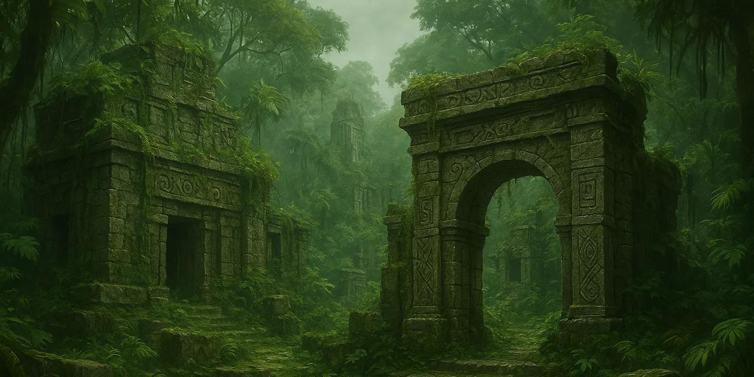
Sambalot
Sambalot is a small island in the Kapuluan archipelago, located about a mile northeast of the larger island of Balugo. It forms part of the Lalawigan ng Balugo and is best known for the ancient, long-abandoned city of Rizao. This city was built by the ancestors of the Tawung people, who were later driven from the island when it was conquered by the Tagápulo Empire. Today, Rizao is considered cursed, and those who attempt to enter it without a Tawung guide are said to meet a terrible fate.
The city is not the only relic of the ancient Tawung civilization - artifacts and ruins are scattered across the island, many of which are highly prized by collectors. Although the island's primary livelihood is agriculture, many farmers also devote time to hunting for Tawung relics to sell. They even train one of the local animals - the warty pig - to aid in the search. These pigs are remarkably adept at sniffing out buried treasures, and a skilled snuffler might be spared the slaughter that awaits most of its kind.
Notable Spirits
The people of Sambalot have long sought to keep the island's gods from realizing that the Tawung are gone. Like their counterparts on Duhan and elsewhere, these gods sleep most of the time, rousing only during major festivals. At such times, the villagers of Sambalot don costumes to resemble the reptilian Tawung. Whether the gods are fooled remains uncertain - but since they have not risen to destroy the humans, the villagers persist in their masquerade.
Geography
Sambalot is a low-lying island shaped like a spearhead pointing to the southeast. It stretches about 27 miles from north to south and spans roughly nine miles at its widest point. The island is divided between agricultural lands and wild forest, the latter especially dense around the haunted, cursed city of Rizao. The forest shelters several unusual species, including the Sambalot hornbill, which is said to steal valuable objects and hoard them somewhere deep within the city's ruins.
Geographic Details
Location: Southwestern RegionLatitude: 13.08 degrees North
Longitude: 24.32 degrees West
Average Elevation: 75 ft
Highest Point: 751 ft
Lowest Point: -3 ft
Area: 129 sq mi
Related Articles
This article was originally written for Spooktober 2024. You can find all of my Spooktober Articles at Spooktober Central.
This article was originally written for Spooktober 2023. You can find all of my Spooktober Articles at Spooktober Central.


I loved the part about the villagers masquerading as Tawung, it really shows their dedication, and I can clearly picture that scene in my mind. I’m also really curious about the kinds of relics and artifacts that are left in Rizao; it sounds like there could be so many fascinating stories hidden there.
I may expand on the artifacts in Rizao at some point - right now it’s an open plot hook for adventures as needed.