Naril (na.ril)
Naril is a small island in the Mekonggan Archipelago, located southeast of the large island of Bara, near Kambi. It is the territory of the Kedatuan Naril - a kingdom that has held the island for centuries. The people of Naril, who call themselves the Narinon, are dark-skinned humans of the Pulawan ethnicity, distantly related to the Pulawang Maitim of Kabkay.
Throughout its long history, the Kedatuan Naril has remained apart from the endless wars that consume its neighbors on Bara. The Narinon maintain strong defenses, for the Bara Karajan has attempted to conquer the island more than once, but beyond repelling invaders they do not seek war.
In recent years, however, the Tagápulo Empire's expansion has brought great unrest to the region - especially since the Empire purchased Kambi to use as a military base, placing large Imperial forces uncomfortably close to Naril's shores. Thus far, the Narinon have permitted Imperial envoys to visit, but they have resisted diplomatic efforts to draw the Kedatuan deeper into the Empire's sphere of influence. This resistance has not been without cost: the Empire has begun to exert trade pressure on Naril, and many of the island's traditional trading partners are now either subjects or allies of Tagápulo. Imperial envoys have hinted that these relationships may suffer should the Narinon continue to defy the Empire's will.
Notable Spirits
The patron god of Naril and the Kedatuan Naril is known as Barungha. He manifests as a strong man with dark skin and the head of a black-furred lion, bearing a spear and shield. Barungha is a god of protection - according to legend, his roar is powerful enough to strip the sails from a ship and cast men on its deck into the sea.
He is the leader of the island's many spirits, collectively known as the Barungaya. These include both nature and ancestor spirits, who are said to join the Narinon in defending the island in the event of an invasion. While not all of the Barungaya are as loyal or protective as Barungha, none would dare ignore his call to battle and risk incurring the wrath of their king.
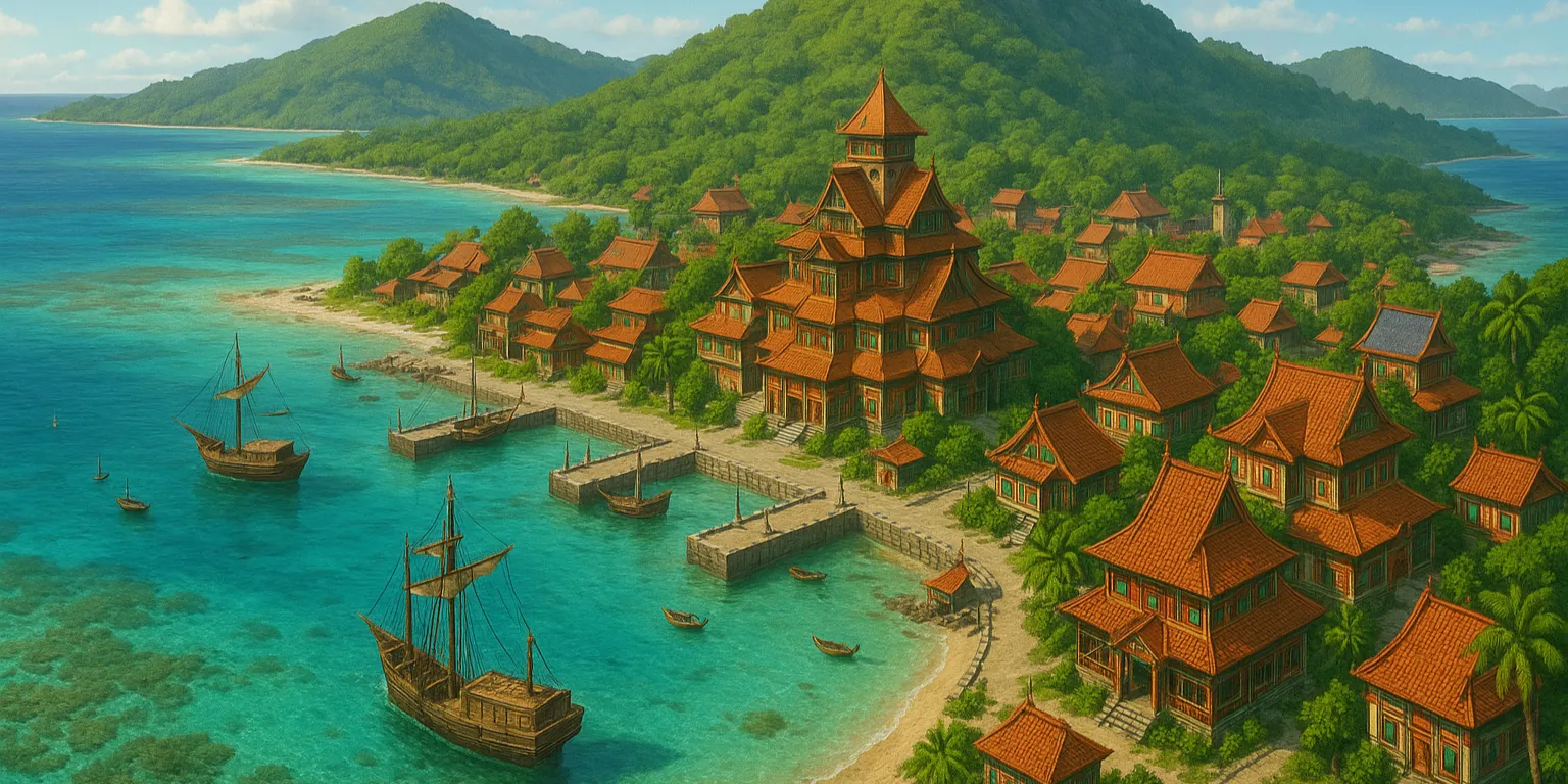
Geography
Naril is often described as having the shape of a broken arrow, stretching forty miles from northwest to southeast, with a maximum width of sixteen miles. It is a low-lying island, with a ridge running along its length that reaches a maximum height of thirteen hundred feet. The shores are sandy and easy to land on, but a coral reef nearly encircling the island makes most approaches hazardous. A lighthouse on Naril's southernmost point warns ships of these dangerous waters and serves as a landmark guiding them to the safest approach.
The largest settlement on the island is Ustu'tun, a port located on the southern coast with a deep natural harbor. Ustu'tun is the capital of the Kedatuan Naril and a common stop for merchants traveling between the Paminta Archipelago and the Mekonggan Archipelago. The interior of the island is largely agricultural, producing sugarcane, coconuts, bananas, and plantains. The island is also known for its unique variety of orchid, from which a particularly fragrant type of vanilla can be derived. This flower grows only in certain, secret parts of the island, making the supply of vanilla quite limited - but this scarcity has enhanced its value to foreign merchants.
Geographic Details
Location: Southwestern RegionLatitude: 22.34 degrees North
Longitude: 48.53 degrees West
Average Elevation: 79 ft
Highest Point: 1,309 ft
Lowest Point: 0 ft
Area: 324.81 sq mi
Related Articles
This article was originally written for Spooktober 2024. You can find all of my Spooktober Articles at Spooktober Central.
This article was originally written for Spooktober 2023. You can find all of my Spooktober Articles at Spooktober Central.

Comments