Balugo (ba.lu.ˈɡo)
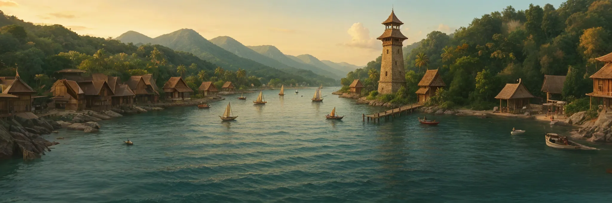
"Spotting the light of the Parola Tultulan on Balugo's southern tip is a great relief after weeks of open ocean."
Balugo is an island in the southeastern portion of the Kapuluan archipelago. It is the closest major island to the Southern Region, and most ships arriving from there will land on Balugo to resupply before continuing on to the larger islands to the northwest. Balugo is the seat of the Lalawigan ng Balugo, a province of the Tagapulo Empire that controls Balugo, Sambalot, and several smaller islands in southeastern Kapuluan. The ruler of the Lalawigan ng Balugo is Lakanlalawigan Dangal ng Bato. Dangal ng Bato is known for his sense of honor and his rigid adherence to the law; many of his colleagues and subordinates find him so rulebound as to be inflexible. In the anticipated succession battles of the Empire, he is aligned with Crown Prince Haribon. He does not care for the prince himself, but he believes the legal succession is inviolate and must prevail.
Notable Spirits
The waters around Balugo are home to the Anito known as Ulung-Bawo, who manifests as a great sea serpent. Ulung-Bawo is one of the most ancient gods in the Southwestern Region and was once worshipped by the Nakaal before humans were summoned into the world. Sailors approaching Balugo know they must make a sacrifice to the god in order to end their journey safely, and will toss coins or meat into the water for Ulung-Bawo. They believe that once they have made their offering, the god will guarantee that they make it to harbor safely, no matter what happens.
Geography
Balugo is shaped like an upside-down V, with the southeastern peninsula extending much farther south than the southwestern. The city of Layagbanwa is located at the southeasternmost point of the island, with the Parola Tultulan marking the entrance to the harbor. Balugo's southeastern peninsula measures a little over sixty miles from the island's northern tip, while the southwestern peninsula extends around eighteen miles. The highest point on the island is Taluktokbundok, in the region where the two peninsulas join. While it is not as high as many mountains, Taluktokbundok has a striking conical shape with extremely steep and regular slopes. Some believe that the shape of the mountain is not quite natural, and that it was sculpted in place by some ancient and strange god.
Geographic Details
Location: Southwestern RegionLatitude: 12.86 degrees North
Longitude: 24.51 degrees West
Average Elevation: 85 ft
Highest Point: 2,244 ft (Taluktokbundok)
Lowest Point: -10 ft
Area: 1,262 sq mi
Related Articles
This article was originally written for Spooktober 2024. You can find all of my Spooktober Articles at Spooktober Central.
This article was originally written for Spooktober 2023. You can find all of my Spooktober Articles at Spooktober Central.


Anito, I could picture so clearly, I also like how they make sacrifices to it for good luck at the end of the journey.
Thanks! I'm glad it was evocative.