Lahat (laˈhat)
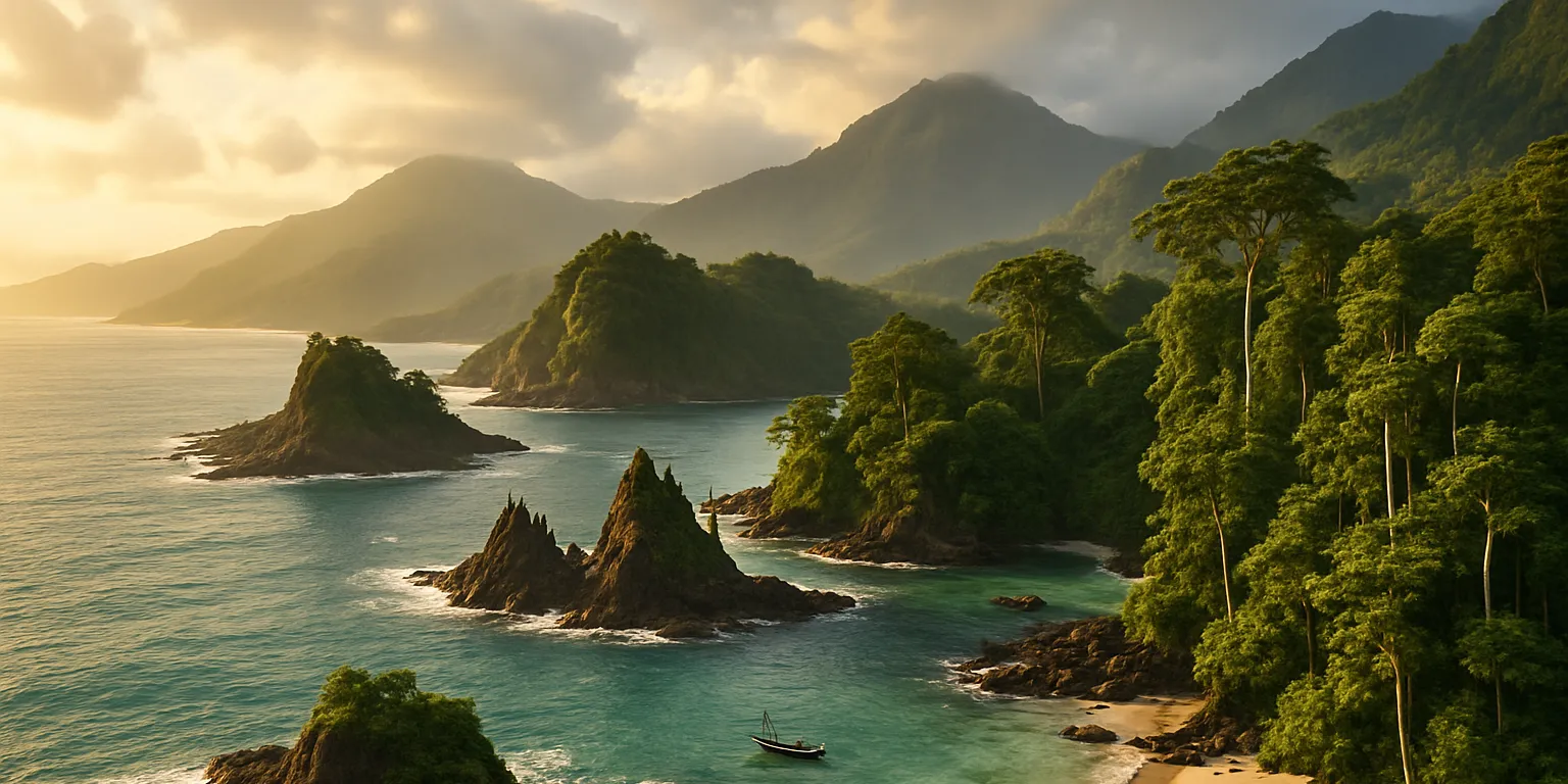
Lahat is the fifth-largest island in the Great Ring and the largest in the Southwestern Region. Its terrain is diverse, ranging from rugged mountains to sprawling savannahs. To the west lies the forest of Pulau Cemara, which is sacred to the Tau Tanah, while the north is home to rolling hills and fertile farmland. The coastline is jagged and rocky, broken up by sandy beaches and hidden coves. On the southern coast stands the great city of Kendari, while the eastern shore is lined with the mobile villages of the Tau Dilaut.
The Kingdom of Lahat rules the island from its capital of Ratubala, situated near the center of the island along the mighty Sungai Manambulu river. The kingdom itself is relatively young: about one hundred and fifty years ago, the Mekongga people of Lampuato fled their dying island and conquered the Tau Tanah and Tau Dilaut tribes of Lahat. Since then, the Mekongga have governed the island, seeking to control as many aspects of life as possible from a network of fortresses and through various mechanisms designed to manipulate Kosalo.
One place, however, remains largely outside their grasp - the great city of Kendari. Though nominally part of the kingdom, Kendari is famed for its independence. It is ruled by a council of merchants who purchase their seats, and it has grown into one of the richest settlements in the world, thanks largely to the pearl beds lying just off the coast. When the Mekongga conquered Lahat, they spared the city and granted it wide autonomy, reasoning that it could not be ruled without irreparably damaging the order of Kosalo, which was already fragile. Yet others tell a different tale of Kendari's survival - whispering that the truth lies with the Aurelian Coin known as Innocentia.
Today, tensions persist between Kendari and Ratubala. The trade city governs itself in ways the Mekongga find offensive, and only the immense wealth it provides to the kingdom secures their tolerance. For their part, Kendari's merchants watch the stern and rigid Mekongga for any sign that this tolerance might falter, seeking to preserve their autonomy with ever more extravagant gifts - gifts that still amount to only a fraction of their fortunes. Caught between the two powers, the Tau Dilaut and Tau Tanah, the island's only native peoples, are largely ignored, left to endure and survive under foreign rule. In the last few years, this balance has also been stressed by a war with the Tagápulo Empire to the east, which has sought to claim all the islands between Pulo and Lahat. The Mekongga have sought to defend the Kingdom's territories without over-extending themselves or creating too much change, and have clamped down on other disruptions at home as a reflex.
Geography
Lahat is one of the largest islands in the Great Ring, covering nearly seventy thousand square miles. The Kupang Mountains dominate the island's eastern reaches, while the south is home to sprawling savannahs, the north to rolling hills and fertile farmland, and the west to a jagged, rocky coastline broken by sandy beaches. The island's largest river is the Sungai Manambulu, which links the capital of Ratubala with the coastal city of Kendari and flows through Lahat's most populous and productive regions. Most of the Mekongga live along its banks, while the surviving Tau Tanah are largely relegated to Kosalo Villages, placed at strategic points elsewhere on the island.
In the east stands Gunung Tambunti, the tallest peak in the Kupang range and one of the highest mountains in the Great Ring, rising to more than eleven thousand feet. It is renowned for the strange cave paintings scattered along its slopes and for the temple that once guarded their secrets. The Mekongga have sought to restore the temple's original purpose - but much of the knowledge required was lost in their own invasion.
Far to the south lies Batu Rintis, a striking geological formation whose name means "Dancing Stones." Here, massive boulders appear to defy gravity, frozen in mid-motion, creating a mesmerizing natural spectacle. Batu Rintis is counted among the great natural wonders of the world, and countless myths and legends are woven around its mysteries.
Another notable feature of the island is Danau Harimau, a vast lake in southwestern Lahat that spans more than two hundred square miles. It is famed for its many unique species, including the freshwater Lahatian shrimp - considered by many to be one of the finest delicacies in the world.
Perhaps the most enigmatic feature of the island is the Lompiran Basin, said to lie hidden in the heart of Lahat. The basin has a reputation as a place of mystery and legend. Despite years of searching, the Mekongga have never been able to find it. Many dismiss it as a myth, while others believe it shelters the last free community of the Tau Tanah.
Maps
-

Lahat
Geographic Details
Location: Southwestern RegionLatitude: 25.71 degrees North
Longitude: 62.98 degrees West
Average Elevation: 476 ft
Highest Point: 11,171 ft (Gunung Tambunti)
Lowest Point: -10 ft (Lompiran Basin)
Area: 69,761 sq mi
This article was originally written for Spooktober 2024. You can find all of my Spooktober Articles at Spooktober Central.
This article was originally written for Spooktober 2023. You can find all of my Spooktober Articles at Spooktober Central.

Ooo, floating boulders. Intriguing. Love the complicated politics of this place. There's so much scope for stories.
Explore Etrea | WorldEmber 2025
Thank you!