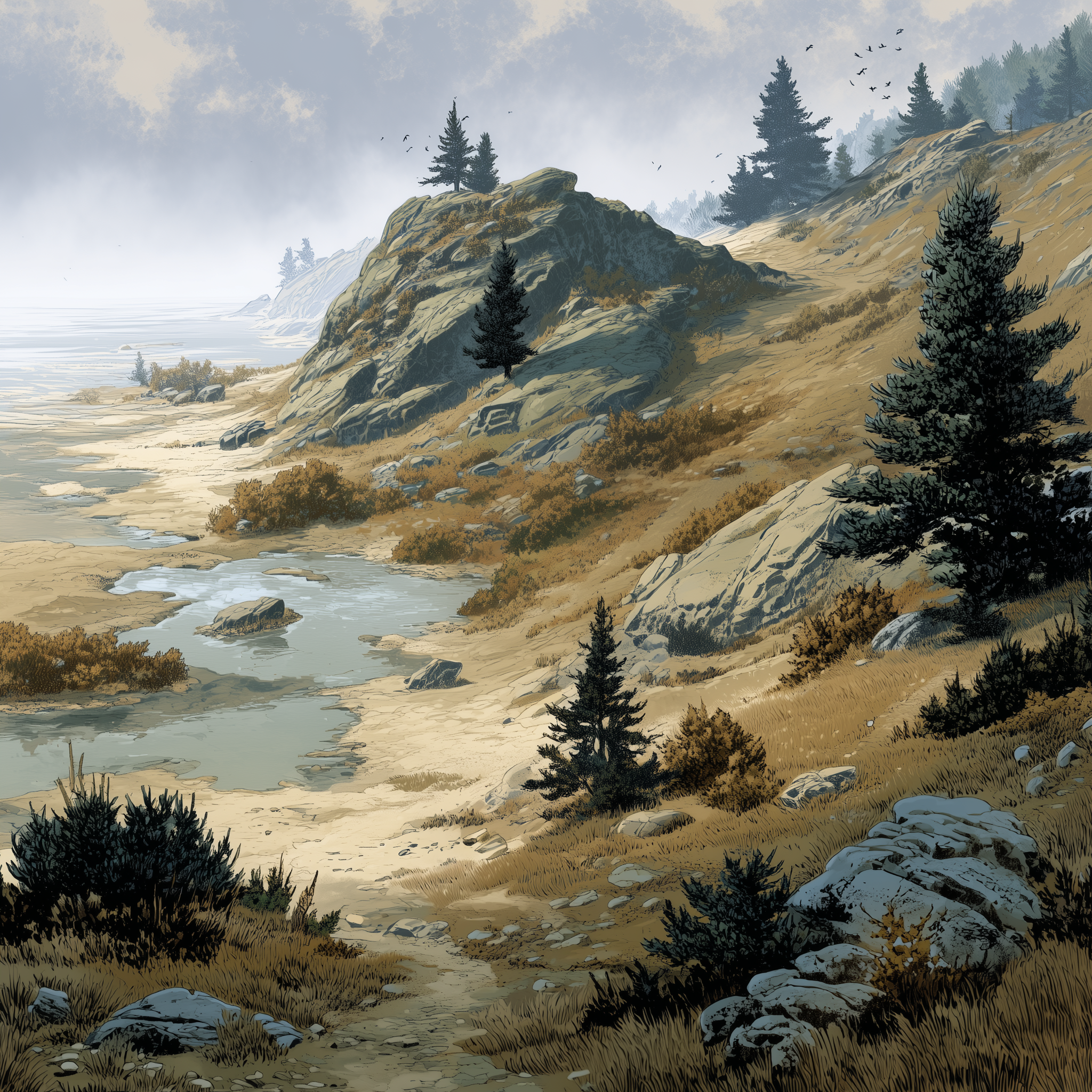
Bahtfall
The Bahtfall is a moraine field that stretches across Stolm Nelsbaht. Formed by ancient glacial advance and retreat, it is a landscape of accumulation and redaction, later reshaped by river flow from the Bahtmyrd and the tides of the The Blau Sea. Rather than a single dramatic feature, the Bahtfall is a broad, uneven body of land, always shifting a little underfoot.
Geography
Long ridges of boulder and rock rise and fall unpredictably, running parallel to the coast in some places and cutting across it in others. Between the ridges lie low basins and shallow depressions that collect water seasonally , sometimes permanently. These basins sometimes form slow-moving channels that shift year by year as sediment settles, or is washed away by flooding.
Climate
Winds are strong but inconsistent, channeled and redirected by ridges rather than sweeping freely across open ground. Fog settles heavily in the low basins and marshes, often lingering long after higher ground has cleared.
Rain and sleet are frequent, and drainage is uneven. One ridge may shed water cleanly while the next turns soft and unstable. Freeze–thaw cycles are especially damaging, forcing constant repair of walls, roads, and foundations. Flooding is common in the basins during seasonal river swell and high tides, but rarely uniform or predictable.
Fauna & Flora
Plant life in the Bahtfall reflects its patchwork terrain. Hardy grasses, shrubs, and low trees dominate ridge tops, their roots twisting around stone rather than sinking deep. In the basins, reeds, sedge, moss, and salt-tolerant plants thrive in damp, brackish conditions
Deer, boar, foxes, and wolves travel along stable ridge lines, while rarer elk follow ancient paths during seasonal migrations. Beavers and otters shape the wetter basins and channels, and amphibians thrive in the brackish pools left by flood and thaw. Birdlife is constant and varied: seabirds nest along coastal escarpments, while ravens, herons, and migratory waterfowl occupy ridges, reeds, and marsh edges.
History
The Bahtfall is older than any state that has claimed it. Formed by ancient glacial movement, the moraine was already a shifting, uneven landscape when early coastal peoples settled its ridges and learned to live with its slow instability.
Points of Interest
The Old Ridgeway
A sinuous path following the most stable moraine crest through the Bahtfall. Portions are paved, others little more than packed gravel.
The Buried Halls
Subsurface ruins exposed intermittently after hard winters or excavation. These stone chambers are believed to be pre-republic storehouses or gathering spaces, now filled with silt and water
The Long Tongue
The Long Tongue is a low, uneven stretch of moraine reaching toward the sea south of Ubblesfellen, technically part of the Bahtfall but treated as something apart. The ground here never quite dries, fog gathers without invitation, and distance feels unreliable, making travel possible but persistently uncomfortable.

Comments